Powered By Blogger

Touristic Sites In Jordan

Amman is the capital of the Hashemite Kingdom Of Jordan Near Amman (AlSalt,Wadi Seer) 1-- North and West of Amman(Jerash,‘Ajloun,Irbid,Umm Qais,Hemma,Umm al-Jimal) The Jordan Valley(The River Jordan,The Dead Sea,Deir Ain Abata Deir ‘Alla,Tabaqat Fahl) 2-- East of Amman: The Desert Castle Loop(Qasr al-Hallabat,Azraq Oasis,Qasr al-Azraq,Shomari Wildlife Reserve ,Qusayr ‘Amra,Qasr al-Harraneh,Qasr al-Mushatta Qastal) 3-- South of Amman(The King’sHighway,Madaba,MountNebo, Mkawer,Hammamat Ma’een,Karak,Khirbet al-Tannur,Tafileh ,Shobak,Dana Nature Reserve Wadi Rum) 4-- Petra 5-- Aqaba 6-- The Ancient Holy Land 7-- Islamic Holy Sites in Jordan
Showing posts sorted by relevance for query Nymphaeum. Sort by date Show all posts

Saturday, March 10, 2012

Nymphaeum, Jerash

Nymphaeum, Jerash

The Nymphaeum (a public fountain) of Jerash was built towards the end of the second century AD, when the city (and indeed the entire Roman Empire, according to Gibbon) was "most prosperous and happy" under the Antonines. In the foreground is a circular basin that received waters from the fountain, which were conducted through pipes whose outlets are visible in the background (center of the lower course) of this photo.
-----------------------------------------------------------------------------------------------------
Italiano.

Ninfeo - Jerash, Giordania

Il Ninfeo (una fontana pubblica) di Jerash è stata costruita verso la fine del II secolo dC, quando la città (e in effetti l'intero Impero Romano, secondo Gibbon) è stato "più prospera e felice" sotto gli Antonini. In primo piano è una vasca circolare che ha ricevuto le acque della fontana, che sono stati condotti attraverso i tubi le cui uscite sono visibili sullo sfondo (centro del corso inferiore) di questa foto.

Monday, February 13, 2012

Nymphaeum, Jerash


Nymphaeum, Jerash
The Nymphaeum (a public fountain) of Jerash was built towards the end of the second century AD, when the city (and indeed the entire Roman Empire, according to Gibbon) was "most prosperous and happy" under the Antonines. In the foreground is a circular basin that received waters from the fountain, which were conducted through pipes whose outlets are visible in the background (center of the lower course) of this photo.

Thursday, February 16, 2012

Pedimental Decoration Nymphaeum, Jerash


Pedimental Decoration
Nymphaeum, Jerash

A fine vegetal motif decorates the pediment of Jerash's Nymphaeum, testifying to 

Saturday, February 25, 2012

The seven hills of Amman


The seven hills of Amman


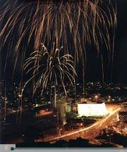
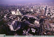
The seven hills of Amman are an enchanting mixture of ancient and modern. Honking horns give way to the beautiful call to prayer which echoes from the stately minarets which grace the city. Gleaming white houses, kabab stalls and cafés are interspersed with bustling markets—known in Arabic as souqs—and the remains of civilizations and ages long past. Sunset is perhaps the best time to enjoy Amman, as the white buildings of the city seem to glow in the fading warmth of the day. The greatest charm of Amman, however, is found in the hospitality of its residents. Visitors to Amman—and the rest of Jordan, for that matter—are continually surprised by the genuine warmth with which they are greeted. "Welcome in Jordan" is a phrase visitors will not soon forget.

Amman is built on seven hills, or jabals, each of which more or less defines a neighborhood. Most jabals once had a traffic circle, and although most of these have now been replaced by traffic lights, Amman’s geography is often described in reference to the eight circles which form the spine of the city. First Circle is located near downtown, and the series extends westward through Eighth Circle.

 History

Amman has served as the modern and ancient capital of Jordan. It is one of the oldest continuously inhabited cities in the world, with a 1994 excavation uncovering homes and towers believed to have been built during the Stone Age, circa 7000 BCE. There are many Biblical references to the city, which by about 1200 BCE had become the Ammonite capital ofRabbath-Ammon. The Ammonites fought numerous wars with Saul, David and others.

The history of Amman between the end of its Biblical references (around 585 BCE) and the time of the Ptolemies is unclear. We do know that the city was renamed Philadelphia after the Ptolemaic ruler Philadelphus in the third century BCE. After coming under Seleucid and Nabatean rule, Philadelphia was taken by the Roman vassal King Herod in 30 BCE. The city became part of the Decapolis League, a loose alliance of ten Roman-ruled cities including Jerash, Gadara (present-day Umm Qais), Pella, Arbila (Irbid) and others. Under Roman rule, Philadelphia was replanned and reconstructed in typically grand Roman style with a colonnaded street, baths, an amphitheater and impressive public buildings.

During the Byzantine period, Philadelphia was the seat of a Christian bishop, and several expansive churches were built. The city declined somewhat during the late Byzantine years, and was overrun by the Persian Sassanians in 614 CE. Their rule was  short-lived, however, collapsing before the Arabian armies of Islam around the year 635. The name of the city then returned to its Semitic origin of Ammon, or "Amman." It remained an important stop on the caravan routes for many years, but eventually trade patterns shifted and dried up the lifeblood of Amman. The city declined to little more than a provincial village for many centuries.
Amman’s "modern" history began in the late 19th century, when the Ottomans resettled a colony of Circassian emigrants there in 1878. Many of their descendants still reside in Amman. During that time and the early decades of the 20th century, the neighboring city of Salt was more important as a regional administrative and political center. However, after the Great Arab Revolt secured the state of Transjordan, Emir Abdullah bin al-Hussein made Amman his capital in 1921

Since then, the city has grown by leaps and bounds into a modern, thriving metropolis of well over a million people. Amman’s growth has been driven largely by political events in the region, and especially by the Arab-Israeli conflict. After the wars of 1948 and 1967, successive waves of Palestinian refugees ended up in Amman. Moreover, the city’s population was further expanded by another wave of immigrants arriving from Iraq and Kuwait during the 1990-91 Gulf Crisis


 Sights of Interest


Most of Amman’s noteworthy historical sites are clustered in the downtown area, which sits at the bottom of four of Amman’s seven hills, or jabals. The ancient Citadel, which towers above the city from atop Jabal al-Qala’a, is a good place to begin a tour of the city. The Citadel is the site of ancient Rabbath-Ammon, and excavations here have revealed numerous Roman, Byzantine and early Islamic remains. The most impressive building of the Citadel, known simply as al-Qasr ("the Palace"), dates back to the Islamic Umayyad period. Its exact function is unclear, but it includes a monumental gateway, an audience hall and four vaulted chambers. A colonnaded street also runs through the complex. To the north and northeast are the ruins of Umayyad palace grounds.

Close to al-Qasr lie the remains of a small Byzantine basilica. Corinthian columns mark the site of the church, which is thought to date from the sixth or seventh century CE. About 100 meters south of the church is what is thought to have been a temple of Hercules, today also known as the Great Temple of Amman. The temple was built in the reign of the emperor Marcus Aurelius (161-180 CE), and is currently under restoration.

Also on Citadel Hill, just northwest of the Temple of Hercules, is the Jordan Archeological Museum. This small museum houses an excellent collection of antiquities ranging from prehistoric times to the 15th century. There is an exhibit of the Dead Sea Scrolls, a copy of the Mesha Stele (see Madaba section for explanation) and four rare Iron Age sarcophagi. Museum hours are 08:30-17:00 daily. On Fridays and official holidays the museum is open from 09:00-16:00


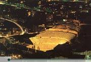
Downhill from the Citadel and five minutes walk east from downtown, the Roman Theater is the most obvious and impressive relic of ancient Philadelphia. The theater, which was built during the reign of Antonius Pius (138-161 CE), is cut into the northern side of a hill that once served as a necropolis—or graveyard. It is very similar in design to the amphitheater at Jerash, and can accommodate 6000 spectators. The theater is still used periodically for sporting and cultural events.


Two small museums are built into the foundations of the Roman theater. The Jordan Folklore Museum is in the right wing of the theater and displays a collection of items showing the traditional life of local people. At the other end of the theater stage, the Museum of Popular Traditions displays traditional Jordanian costumes, including fine embroidery and beautiful antique jewelry. It also houses several sixth-century mosaics from Madaba and Jerash. The Museum of Popular Traditions is open daily 09:00-17:00, and closed on Tuesday. The Jordan Folklore Museum is open every day from 09:00-17:00, except Friday when its hours are 10:00-16:00.

To the northeast stands the small theater, or Odeon, which is still being restored. Built at about the same time as the Roman theater, this intimate 500-seat theater is used now as it was in Roman times, for musical concerts. Archaeologists think that the building was originally covered with a wooden or temporary tent roof to shield performers and audiences from the elements. Heading southwest from the theater complex, Philadelphia’s chief fountain, or Nymphaeum, stands with its back to Quraysh Street. Much of the fountain, which was completed in 191 CE, is hidden from public view by private houses and shops.


 The Nymphaeum is believed to have contained a 600 square meter pool, three meters deep, which was continuously refilled with fresh water. Jordan’s Department of Antiquities is currently excavating the Nymphaeum, and ultimately hopes to restore the site to its original structure by 2010.

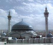
From the Nymphaeum, the short stroll to the King Hussein Mosque bustles with pedestrians, juice stands and vendors. The area around the King Hussein Mosque, also known as al-Husseini Mosque, is the heart of modern downtown Amman. The Ottoman-style mosque was rebuilt in 1924 on the site of an ancient mosque, probably also the site of the cathedral of Philadelphia. Between the al-Husseini Mosque and the Citadel is Amman’s famous gold souq, which features row after row of glittering gold treasures


.

Saturday, March 10, 2012

Pedimental Decoration

Pedimental Decoration

Nymphaeum, Jerash
A fine vegetal motif decorates the pediment of Jerash's Nymphaeum, testifying to the very high level of craftsmanship that existed in Jerash at that time.

Thursday, February 23, 2012

Umm Qais, Jordan


Umm Qais, Jordan

Umm Qais, situated 110 km north of Amman on a broad promontory 378 meters above sea level with a magnificent view over the Yarmouk River, the Golan Heights, and Lake Tiberias, this town was known as Gadara, one of the most brilliant ancient Greco-Roman cities of the Decapolis; and according to the Bible, the spot where Jesus (pbuh) cast out the Devil from two demoniacs (mad men) into a herd of pigs (Mathew 8:28-34).

In ancient times, Gadara was strategically situated, laced by a number of key trading routes connecting Syria and Palestine. It was blessed with fertile soil and abundant rainwater. This town alsoflourished intellectually in the reign of Augustus and became distinguished for its cosmopolitan atmosphere, university's scholars, attracting writers, artists, philosophers and poets, the likes of satirist Menippos (2nd half of the 3rd century BC), the epigrammist Meleagros, and the rhetorician Theodoros (14-37 AD). Gadara was also the resort of choice for Romans vacationing in the nearby Himmet Gader Springs.
Archaeological surveys indicate that Gadara was occupied as early as the 7th century BC. The Greek historian, Polybius, described the region as being under Ptolemaic control at the time. The Seleucid ruler Antiochus III conquered it in 218 BC, naming the city Antiochia and Seleucia. In 63 BC, Pompey liberated Gadara and joined it to the Roman league of ten cities, the Decapolis.
Soon after, the fortunes of Gadara improved rapidly and building was undertaken on a large scale, carried out for the love of Pompey's freed man Demetrius, who had been born there.

During these early years of Roman rule, the Nabataeans (with their capital in Petra), controlled the trade routes as far north asDamascus. Unhappy with the competition,Mark Anthony dispatched King Herod the Great to weaken the Nabataeans, who finally gave up their northern interest in 31 BC. In appreciation for his efforts, Romerewarded Herod with Gadara.
The city reached its peak of prosperity in the 2nd century AD. New colonnaded streets, temples, theaters and baths sprouted. Meleagros compared Gadara with Athens, which testifies to the city's status as a creative center of Hellenism in the ancient Near East.
Christianity spread slowly among the inhabitants of Gadara. Starting from the 4th century, its bishop attended the ecclesiastical councils of Nicaea, Chaleedon and Ephesos. Despite his attendance, the city was no longer a seat of learning. During the 6th century, decline set in, and in 636 AD a decisive military clash between Byzantines and Arab Muslims took place not far from Gadara. There is no evidence, however, of widespread destruction in the city.


Umm Qais's charm still lingers today. A large portion of the western Roman Theater has survived history's upheavals. Vaulted passageway supports its rows of seats, built of hard basalt stones. A row of elaborately carved seats for dignitaries stand near the orchestra, and in the center was a large headless white marble statue of Tyche, goddess of fortune and of the city, now displayed at the local museum.
Across from the theater is the main colonnaded street (cardo), which was in all likelihood the town's commercial center. Also, near the black basalt theater is the Terrace, which hosts a courtyard, a church and a basilica. Further west of the Terrace and along the east-west colonnaded street (decumanus), ruins of the Nymphaeum, a bath complex and a well-preserved Roman Mausoleum can be seen. After a few hundred meters one can barely make out remains of what was once a Hippodrome.


Wednesday, March 6, 2013

Jerash (Gerasa)

Jerash (Gerasa): The Jewel of the north.


The Jewel of the north. One of the most visited site. Jerash is one of the preserved Greco-Roman cities in the world, and example of the Roman civilization. Jerash was called Gerasa in the bible It is mentioned that it was built by the soldiers of Alexander the Great the city features theaters, churches, temples (Zeus & Artemis), a Nymphaeum, and colonnaded streets. Some of the pagan temples were turned into churches with mosaic floors in the year 396.3


Jerash, the Gerasa of Antiquity, is the capital and largest city of Jerash Governorate (محافظة جرش), which is situated in the north of Jordan, 48 kilometres (30 mi) north of the capital Amman towards Syria. Jerash Governorate's geographical features vary from cold mountains to fertile valleys from 250 to 300 metres (820 to 980 ft) above sea level, suitable for growing a wide variety of crops.


A strong earthquake in 749 AD destroyed large parts of Jerash, while subsequent earthquakes along with the wars and turmoil contributed to additional destruction. Its destruction and ruins remained buried in the soil for hundreds of years until they were discovered by German Orientalist Ulrich Jasper Seetzen in 1806[2] to begin excavation and to return life to rise to the current Jerash by inhabitants of old villages. Then followed 70 years after by the community of Muslims, Circassians, who emigrated to Jordan from the land of the Caucasus in 1878 after the Ottoman-Russian war. And a large community of people of Syria at the beginning of the 20th century.

The hippodrome

The South Gate

Northern Tetrapylon

Mosaic at the Christian Church


Monday, February 13, 2012

jerash nymphaeum


Friday, February 17, 2012

Jerash, Gerasa


Jerash , Gerasa

Dubbed the "Pompeii of the East," Jerash is a Greco-Roman ruined city located 80 miles north of Amman. The impressive, beautifully preserved ruins of Jerash include places of worship and other buildings from the Hellenistic, Roman, Byzantine and early Muslim periods.

History

In the 3rd century BC, during the Hellenistic era, Jerash became a member of the Decapolis, a federation of Greek cities. It was then known as Gerasa.

Gerasa and other Decapolis cities were conquered by Pompey in 63 BC, which ended up being a positive development. Jerash enjoyed semi-autonomous status and considerable prestige as part of the Roman province of Syria, during which it prospered from its position on the incense and spice trade route.

Jerash lost its autonomy under Emperor Trajan, but his annexation of Petra in 106 AD brought the city even more wealth. A favorite city of Hadrian, who stayed there in the winter of 129-30, it flourished both economically and socially in the 2nd century. Several temples were built during this period, including the Temple of Artemis (in 150 AD) and Temple of Zeus (in 162 AD).

After a period of decline in the 3rd century, Jerash was reborn as a Christian city under the Byzantines. It flourished especially during the reign of Justinian (527-65), during which at least seven churches were added to the city.

The last church was built in 611, but it all went downhill from there. The city was invaded by Persians in 614, captured by Muslims in 635 and badly damaged by several earthquakes in the 8th century.

In 720, Caliph Yazid II decreed that "all images and likenesses in his dominions, of bronze and of wood and of stone and of pigments, should be destroyed." Obedience to this command can be seen in the mosaics of some of Jerash's churches, such as that of St. John the Baptist. But others, already so ruined that their mosaics were not visible (such as the Church of Sts. Cosmos and Damianus), escaped the destruction

By the time the Crusaders arrived in the 12th century, Jerash had been unhabited for some time. Unfortunately, a garrison stationed in the area by the Atabey of Damascus made the Temple of Artemis into a fortress, which was captured and completely destroyed (apparently by fire) by King Baldwin II of Jerusalem in 1112.

Excavations of Jerash began in the 1920s and are still going on today.

What to See

Jerash is a large and fascinating archaeological site. Visitors enter on the south side through Hadrian's Arch, built in honor of its namesake. Nearby is the Hippodrome, where chariot races and sporting events were held. A little way down the track is the South Gate, part of the 4th-century AD city wall.

The Temple of Zeus overlooks the spacious Oval Plaza, which measures 90 x 80m. Surrounded by a colonnade of 1st-century Ionic columns, it had two altars in the middle that were replaced with a fountain in the 7th century AD. A central column was recently erected to carry the Jerash Festival flame.

From the Oval Plaza, a staircase leads up to the sacred precinct (temenos) of the Temple of Zeus (162 AD). Another staircase led to the temple itself, which was surrounded by 15 m high Corinthian columns.

Stretching north from the Oval Plaza is the Cardo Maximus, the main Roman road in Jerash. It is still paved with its original stones and bears the ruts of chariot wheels. As part of a remodeling of the street around 170 AD, the original Ionic columns were replaced with a more decorative Corinthian colonnade. The Cardo was lined with a broad sidewalk and shops and an underground sewage system ran the full length of the street, into which rainwater was channeled through holes on the sides of the street.

Not far from the Oval Plaza on the right is the onsite Archaeological Museum, which houses a fascinating collection of artifacts found at the site, including gold jewelry, coins, glass and even pottery theater tickets.

The colonnade of the Cardo becomes taller at the entrance to the marketplace (Macellum), a ruined structure on the left. Here there is a fountain with a lion's head dated to 211 AD. The next structure down the Cardo after the marketplace is a recently discovered Umayyad Mosque, where excavations are still underway.

Shortly after the mosque is the South Tetrapylon that marks the intersection of the Cardo with the South Decumanus, a smaller street running east to west. Only the lower parts of the four columns marking the intersection remain today.

Continuing north on the Cardo, the next building on the left is the richly carved gate of the 2nd-century Roman Temple of Dionysus, which was rebuilt as a Byzantine church in the 4th century. It has been dubbed the "Cathedral," but there is no evidence this was the bishop's church. At the top of the stairs against the east wall is a Shrine of the Virgin Mary, with a painted inscription to St. Mary and the archangels Michael and Gabriel.

Just behind the Cathedral is the large Church of St. Theodore, built in 496 AD. In between the two churches is a small paved plaza with a fountain in the center, which was originally the Cathedral atrium.

Behind St. Theodore on the far west of the site, the ruins of three Byzantine churches are grouped together around a shared atrium. The northernmost is the Church of St. Cosmos and St. Damian, dedicated to twin brother doctors who were martyred in the 4th century (they have a fine church in Rome as well). This church has the most splendid floor mosaics to be seen in Jerash. An inscription dates the mosaic to 553 AD. The images include the churchwarden Theodore and his wife Georgia praying with widespread arms.

The middle of the three churches is that of St. John the Baptist, dating from 531 AD. Its mosaic floor, now damaged, included images of the four seasons, plants and animals, and the cities of Alexandria and Memphis in Egypt. The church of St. George, the southernmost, was built in 530 AD. It continued to be used after the earthquake of 749 AD, and its mosaics were destroyed when the 8th century Christian iconoclastic movement banned the representation of humans and animals.

Back on the Cardo, just north of the Cathedral is a large nymphaeum, or monumental fountain. It was constructed in 191 AD and was faced with marble. Next is the Propylaeum or gateway that led to the sacred precinct of the Temple of Artemis (150 AD), which occupies a large site to the left of the Cardo. A monumental staircase, which once had high walls, leads up to a horseshoe-shaped terrace with the foundations of an open-air altar. A second staircase leads through a colonnade of 22 Corinthian columns and into the Temenos (sacred precinct), which measures 162 x 121 m and had Corinthian columns on all sides.

In the 6th century, a Byzantine church (the "Propylaeum Church") was built opposite the Propylaeum on the site of a courtyard that formed part of the processional way to the Temple of Artemis. The courtyard's columns were incorporated into the church.

Past the Temple of Artemis and left of the Cardo is a small theater or Odeon, built in 165 AD and doubled to its present size in 235 AD. West of the Odeon is the Church of the Bishop Isaiah, built in 559 and used until the earthquake of 749. Here the Cardo intersects with the North Decumanus, which is marked by the North Tetrapylon. In the 2nd century this probably had a domed roof and elaborate carved decoration.

Festivals and Events

The Jerash Festival is held each year for 2 weeks in July (contact Jordanian Tourism Information offices or www.jerashfestival.com.jo for current information).

Tip: School trips to Jerash usually occur on Wednesdays.

Quick Facts

Site Information
Names: Jerash
Location: Jordan
Faiths: Original/Primary: Ancient Roman
Current/Secondary: Christianity
Categories: City Ruins; Roman Temples
Architecture: Classical, Paleochristian
Status: ruins

Visitor Information
Coordinates: 32.281899° N, 35.891004° E   (view on Google Maps)
Lodging: View hotels near this location
Phone: Jerash Visitors' Center: 04/451-272
Jerash Archaeological Museum: 04/452-267